HOME
Home | Guide | Directory
Search for:   In:
Menu

spacer Home
spacer GuestBook
spacer Calendar
spacer Forums
spacer
Home Weather
spacer Classifieds
spacer Kids Zone
spacer Movies
spacer Iola Guide
spacer Business Directory
spacer Maps
spacer Media Gallery
spacer Tell a friend
spacer Update Me

Weather Info

spacer Extreme Heat Tips 
spacer Storm Shelters

spacer Tornado Safety
spacer Tornado FAQ
spacer Lightning Safety
spacer Fujita Scale

NOAA Radio

NOAA transmits weather information in this area from station WXK-95 at 162.400 MHz


Pollen Report

 
Facts

Tornados in Kansas, 1999

Tornadoes: 64 (16 above normal, and 54 below record of 118 in 1991)

Deaths: 6 (most since 1993)

Injuries: 155 (most since 1991)

Longest Track: 24 miles, Sumner into Sedgwick counties

Strongest:
F4, Sedgwick County, on May 3

Most in a county: 6, Sedgwick

Days of occurrence: 22

Most in one day: 12 on May 4

First touchdown of the year: April 3, Cherokee County

Last touchdown of the year: Sept. 26, Reno County

Most in a month: 32, May

Property damage estimate: $152 million

1999 monthly tornado totals:
April, 11;
May, 32;
June, 13;
July, 6;
September, 2.

Source: National Weather Service


Allen County Current Conditions
 

IolaCast
Get the local weather forecast delivered to your email box every morning!

Enter Your Email Address below:

Current Conditions in Allen County

At: Real Time Weather Currently Offline

NOAA Watches and Warnings

Current Kansas Watches and Warnings
Current severe weather
watches and warnings

(Texas A & M University)

Todays Minimums and Maximums
(since midnight)
Yesterday's Minimums and Maximums
Last 24 hours data, hour by hour

Sunrise and Sunset for Today

Sunset: 06:42 pm
Sunrise: 06:07 am
Moonset: 03:48 am
Moonrise: 01:41 pm

Iola Weather History for Today

Avg. High Temp: 65 °F
Average Low Temp: 39 °F
Record High Temp: 87 °F 1966
Record Low Temp: 23 °F 1987
Record Rainfall: 1.10 In 1967
Record Snowfall: 0.00 In Missing


Southeast Kansas Current Road Conditions
Kansas Road Information Service
Kansas Turnpike Conditions
Current Kansas Road Construction and Detours
Missouri Road Conditions
Southeast Kansas Radar

Local Radar Image

Area Radar Sources

NWS Wichita, KS
NWS Tulsa, OK
NWS Kansas City, MO
NWS Springfield, MO
NWS 4 State Area
Spirit 6 KOTV Tulsa
Realtime High Resolution Radar
KSN Wichita
KSHB 41 Kansas City
KSN TV Joplin
NOAA RCM Radar
NOAA NEXRAD
NOAA National Radar

Forecast

 
TONIGHT SATURDAY SATURDAY
NIGHT
SUNDAY SUNDAY
NIGHT
Clear
Clear
Mostly Sunny
Mostly
Sunny
Partly Cloudy
Partly
Cloudy
Mostly Sunny
Mostly
Sunny
Increasing Clouds
Increasing
Clouds
Lo 57°F Hi 80°F Lo 57°F Hi 80°F Lo 57°F

National Weather Service
Zone Forecast


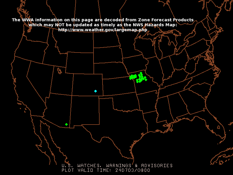
SPC Watch, Warning and Advisory

Click Here to Zoom in

SPC 6-Hour Thunderstorm Outlook

Click Here to zoom in
GOES 8 East Satellite


GOES 8 Channel 1 ZOOM


GOES 8 Channel 2 (click to zoom in)

Infrared - Visible - Water Vapor

NOAA

Instantaneous Estimated Rainfall Rate
Estimated 24hr Rainfall

High Density Wind Patterns Current
Soil Wetness Index 5 Day Avg.

Neosho River Flow & Height
Burlington Kansas
Flow:%%burflow%% gps
Stage: %%burstage%% ft.
Rain Fall (last 24hrs): %%burrain%% inches
Recorded on: %%burdate%%
Chart
Iola Kansas
Flow: %%iolaflow%% gps
Stage: %%iolastage%% ft.
Rain fall (last 24hrs):%%iolarain%% inches
Recorded on: %%ioladate%%
Chart

The Weather Conditions on this site are recorded and observed in Allen County, Kansas on the West edge of La Harpe, approximately 7 miles East of Iola on US 54 Highway. Temperatures may be slightly cooler than those observed in neighboring citys due to the lack of building structures and pavement in the area. Sky conditions are based on NOAA IWIN data from the Chanute airport.

Important Note
The weather information on this site is not for protection of life or property.


Iola.com - Where Iola Kansas clicks

Home | Search | Guide

Beyond Engineering
Privacy Policy and Legal Notices

Copyright © 2010 Beyond Engineering